Products
/
/
Maps for transport and logistics
Proprietary Infrastructure

Maps built for trucks, fleets, and logistics operations.

Placematic Maps for Transport and Logistics delivers map data with truck-specific road restrictions, toll costs, and logistics-optimized layers — for fleet management, dispatch systems, and supply chain applications.

Truck restrictions
weight · height · hazmat
Toll costs
parking · ZIP code data included
Works with
Leaflet, OpenLayers, HERE Maps SDK and more
TRANSPORT & LOGISTICS · PLACEMATIC
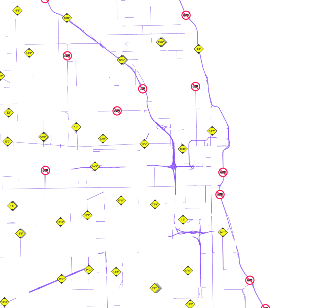
Precise for trucks

Road data includes restrictions for heavy goods vehicles — bridge heights, weight limits, axle load, and hazmat routes. Your fleet always gets a route that the vehicle can legally and safely complete.

Toll costs

Calculate the exact cost of tolls for each journey — nationally and internationally. Toll data covers road and ferry pricing across all markets your fleet operates in.

ZIP codes and parking lots

Shows the location and number of available parking spaces — for trucks, cars, and hazmat vehicles. ZIP code data allows precise area-based delivery planning and route segmentation.
WHY PLACEMATIC Maps for transport and logistics

Why US companies use Placematic Maps for Transport and Logistics.

Six things engineering and data teams consistently call out — built into every plan, from pilot through enterprise.

Weekly updates

Topicality

The basis of good quality maps is their timeliness. Every day 28 terabytes of data are collected which are later processed and made available in weekly updates.
Real-time traffic

Precision

To accurately estimate the route and time, we use historical data on average speeds and traffic. We enrich them with information on current driving conditions updated every minute.
Multi-stop · Fleet

Optimization

With truck route optimization, full economy analysis, and the most accurate routing, customers can more easily interpret the complexity of their routes. As a result, logistics teams gain better visibility across operations.
Truck · HGV · HazMat

Tailored to needs

We provide access to different map styles such as hybrid map, satellite images, versions for mobile devices, current traffic data and navigation options — always improving route planning reliability.
1B+ routes/year

Many satisfied customers

Our route calculation services are integrated in many professional solutions for route planning and optimization available on the market. Every day better — provide a full transport and logistics database on the market.
Leaflet · HERE · OL

Flexibility and completeness

Availabilities are constantly built into our own navigation, maps, brand names and many other mapping libraries available for most logistics applications available on the market.
Try it yourself

Try out a few selected map issues for transport and logistics.

Switch between routing, route optimization, and toll cost views — see how Placematic logistics maps work for your fleet use case.

Live Placematic Maps for Transport & Logistics · Real-time truck restriction data
PRICING ESTIMATOR

Estimate Your Maps for Transport and Logistics API Costs.

Compare estimated costs for Google Maps vs. Placematic Maps Tile API based on your monthly volume.

USE CASES

Who uses Geocoding API

Fleet & ELD
Power dispatcher dashboards and driver apps with truck-specific map layers. Road restrictions, toll overlays, and hazmat zones visualized directly on the map — not just calculated in the routing engine.
Logistics & Delivery
Embed transport-optimized maps in your TMS or WMS. Show delivery zones, route geometries, and real-time vehicle positions on a single map view with truck-relevant data layers.
SaaS platforms
Add logistics-grade maps to any fleet or supply chain product. The same tile API works across Leaflet, OpenLayers, and HERE Maps SDK — no vendor lock-in.

Frequently asked questions.

Standard road maps are designed for passenger cars. Placematic Maps for Transport and Logistics include truck-specific data layers — bridge heights, weight limits, axle load restrictions, hazmat transport rules, and time-based urban access zones. The map rendering reflects what commercial vehicles will actually encounter on the road.

Road restriction data covers height limits, maximum weight (gross vehicle weight and axle load), width restrictions, hazmat transport categories, and time-based access restrictions for urban delivery zones. Data is sourced from HERE’s transportation database and updated weekly.

Yes. Toll cost data is available for roads and ferries across major markets. The API returns toll costs per route segment — useful for pre-trip cost estimation, freight exchange pricing, and fleet cost management.

Yes. The maps include data on truck parking locations and — where available — parking space counts. This is particularly useful for long-haul operations where drivers need to plan rest stops in compliance with hours-of-service regulations.

Placematic transport map tiles work with Leaflet, OpenLayers, and HERE Maps SDK and more. If you’re already using one of these in your dispatch or fleet management system, integration requires only a tile URL swap.

Yes. The API is designed to embed in transport management systems, warehouse management systems, and fleet management platforms. REST API with standard tile formats — compatible with any system that supports web map integration.

Submit a pilot request at placematic.com/start-trial/ and we’ll provide API credentials within 1 business day. No credit card required. If you want to see the maps first, use the interactive demo on this page or book a 20-minute call.

Get details about our Maps for Transport and Logistics API.

Set up your trial today. Send us your email — no credit card required to start.

Placematic USA LLC · Rolling Meadows, IL · We respond within 1 business day